Geospatial Data Manager (CRMIC)
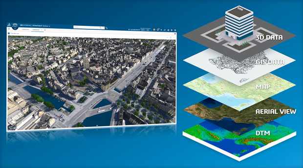
Create and maintain best-in-class territorial virtual twins, enabling sustainable urban transformations and infrastructure projects.
The Geospatial Data Manager role enables users to build and manage virtual twins of natural or built environments. Data managers can harness georeferenced content to enrich geographic areas of reference. Geospatial data can be previewed, qualified, and transformed into datasets that form immersive 3D experiences for project coordination. Each feature is treated as a distinct object with semantic and geometrical representations. From complex 3D models of buildings and vegetation to simple GIS features, this role enables the creation and curation of datasets that sets the new benchmark for semantic-rich and contextual collaboration.